Day 31 – Friday 21 November – Haast to Wanaka

It was another snuggly feeling to be in bed listening to the rain on the roof, but unfortunately not so snuggly at get up time when the sound and and the rain was unchanged!

I rescued Mr Scott from the shed and then it was on the road shortly after 7.30am with the plan for breakfast at Makarora some 70 odd ks down the road.

I had to laugh in leaving the sort of deviation you use from the main road to get to Haast Village and there was a sign that said you are now leaving the CBD!

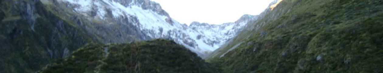
Although there was heavy rain and low fog, there was no wind and it was not really cold, although I knew that this would probably come once I got fully wet after a couple of hours.. I love coming out of Haast and then into the valley leading to the pass as the valley gets narrower and you know that a climb is coming, but still every k ticked off on the “flat” which is actually a steady climb, is one less..

With the rain, unfortunately I was not stopping for photos, but water was streaming everywhere (including from me!) and the waterfalls were spectacular. I think it is called Roaring Billys was in full force and while it was on the other side of the valley, the noise was incredible as was the flow of water.

Equally impressive was the Haast River at the Haast Gates bridge. There was no need to stop like we have on previous occasions to cool down by standing in the river, as the rain was doing this..

It was a bit of a grunt climbing immediately off the bridge, but more so at the upper end of the climb and then it was a bit lumpy for a while with another climb at I think Diana’s Bend or a name like that.. I think this is where the 2 overseas tourists were washed away in their van as there is major construction going on there to stabalise the rock bank and the road has only been recently re-opened 24/7 because of this work.

On the subject of vans, there were a number parked at various places along the side of the road.. Fine I guess if they are not doing their “number 2’s” there as well..

While I know there is high rainfall in the area, there had obviously been a heap of rain as water was pooling everwhere and there were “rivers” flowing swiftly on the sides of the road.

It was good to get out of the forested area as the day looked like it was clearing, although it was still raining and the expected 70ks ended up being closer to 80 which is always a bit of a mental struggle when you have been banking on food at 70ks.

Got to Makarora (no Deerfoots, sorry another private joke for those in the know) and they had a great selection of food including a meat casserole with roasted vegies so this was just what was needed to warm up.. I see they had a pie warmer, but unfortunately no toe warmer oven which is what I really needed!

It was a great breakfast/lunch and I left my wet imprint on the upholstered chair and a puddle on the floor as well..!

It was then 65ks to Wanaka and a wind had sprung up, but finally the wind gods were on my side as it was favourable, so with this and mostly a declining gradient good time was made to the bottom of Lake Wanaka. On one of the early climbs around the lake, the notification went off on my phone for a delayed text which is always a comforting sign when you are finally back in cell phone coverage.

Further down the road there was a massive bank up of vehicles including several buses that had obviously been there for some time as I don’t recall them passing me, the bank up being due to removing loose rock from high up on one of the rocky outcrops. That’s what is good about being on a bike is that you can ride past everyone and get to the front of the queue. I don’t know how long others had to wait, as I was there for about 20 minutes and it was not that pleasant in the wind and rain. Finally got the go ahead and it was me first and due to the road gradient basically declining, it took some time for all the banked up vehicles to pass.

Up and through the narrows and then it was Lake Hawea on the horizion and I had a good look at the terrain for the round the lake mountain bike race and at this point I reconfirmed that I am a “roadie”. Thanks, but no thanks..

I knew that an awful climb was coming. I don’t know what it is called, but goes to a lookout point and is equally as bad from either direction. The first time I saw it was when Al and I were riding south and from a distance I could not believe that we have to ride up that.. It is worse looking at than Bluff Hill. Getting onto it was perhaps not as bad as it looked, but always a relief to get to the top and then when decending, being grateful that you were not climbing that side!

A quick stop at Lake Hawea and then it was on to Wanaka with a stop at the bike shop to borrow a track pump and somewhat surprisingly, there was minimal drop in pressure from leaving home.

The accommodation at the YHA I have a lakeside view room, shared with Mr Scott.

From Lake Hawea it had stopped raining and it was actually quite warm at Wanaka so it was great to feel the warmth, let alone see the sun..

Total for the day was 144k with a climbing elevation of 1,272m.

Surprising to me the average speed today was less than yesterday, I thought it would have been the other way around.

I have accommodation booked for tomorrow, Saturday at Kingston and intend going over the Crown Range. There are several people I know participating in the Queenstown Marathon tomorrow, so depending on the weather and how I am feeling, while I was not intending to go to Queenstown, I may detour there to give some support. So all the best to everyone competing.

Day 30 – Thursday 20 November – Franz Josef to Haast

It was a bit of a surprise given the rain overnight, that the day dawned fine, sunny and clear although I was to find out that this was only for the first hour!

As it was very cool, it was all gear on and a breakfast was planned at Fox, but that was nearly 30ks down the road.

Rolling out on the road just on 7.30am it was cool, but actually quite nice riding as there was thankfully no wind and there were just those group of 3 climbs which are all really continious but nice climbing. There was the odd glimpse of the snow covered mountains between high clouds which even encouraged me to stop for the odd photo. There was quite a lot of helicopter traffic taking tourists on trips.

After breakfast at Fox where I met an owner of a Cafe who had relocated there after his Cafe in Christchurch was destroyed in the earthquakes, it was back on the road to finally pass “Farmer Browns” (basic accommodation where Al and I have stayed previously when Franz was booked) at Jacobs River and then it was a quick stop at Bruce Bay where the surf was really pounding. It was a quick stop as the sandflies must have detected “fresh meat” in the area as they just swarmed and were quite large..

Just south of Bruce Bay the day changed and the rain set in and basically did not stop for the rest of the day. There was a stop at our normal being the Cafe at the Salmon farm just a couple of ks out of Lake Paringa and I had the best whitebait sandwich ever, with 2 large patties between white bread, yum..

While it was raining, at least there was not the wind of yesterday as it was cold and unpleasant enough as it was.. Getting out on the coast I love the way that all the vegetation is sort of mown and even due to the effect of the prevailing wind, makes it look really tidy!

The normal lookout at Knights Point was closed due to landslips, but there was another site offering similar views and despite the overcast and wet day, it was a compulsory photo point.

I was counting down the ks to Haast Junction (a quick look for Jennie at the Service Station which is a private joke) and then it was on to Haast and on the way past 2 touring overseas cyclists with panniers who had ridden from Fox. As I was pretty cold it was nothing more than a quick greeting as established that they were staying at the Wilderness Lodge where I was booked, so would catch up with them later.

Having stayed here before it was familar and a 20 minute shower finally warmed me up before attending to the laundry and bedding Mr Scott down for the night who had the indignity to share a shed with some mountain bikes!

An evening meal was the next challenge as the hotel in the village was closed pending new ownership and as it was still raining heavily, I was not going to bike back to the junction, so I had to resort to making pasta and with only 2 TV channels and no mobile or internet coverage, it was going to be an early night!

Total for the day 143ks with a climbing elevation of 1,272m.

Day 29 – Wednesday 19 November – Hokitika to Franz Josef

Again during the night there was heavy rain (West Coast drizzle), but although it seemed in the morning to have ceased (for the moment!), what was of more concern was the wind and the flag on a neighouring building showed that it would be basically right on the nose, again!

A breakfast at the hotel resulted in a roll out just before 8.30am and the wind had not abated and turning right from Weld Street to head south, felt its full force.. It was a bit of a struggle getting over the bridge for the Hokitika river and a rather unnerving feeling crossing the bridge being buffeted by the wind.

It was a grunt to Ruatapu which was only about 9ks out and Emma’s suggestion that I should be coming up the coast not down it was playing through my mind. It even crossed my mind to turn around to see what it would be like with the wind behind me! At Ruatapu the road direction changed and there was then a slight reprieve from the wind, along with a bit of shelter from the native trees along this section of the road, although further down there was significant damage from wind blown pine trees, I guess a result of the storm that hit the coast during Easter.

In fact there were signs of wind blown trees and I think a few farm buidings all the way to Franz.

Just south of Ruatapu is the new tourist venture of a “tree walk”, but not for me today,the mission was to get to Franz.

Although it was windy and overcast and at times wet, it was not cold, that was to come later in the day!

Through Ross (no stopping), the sun came out, but as was to be the pattern for the rest of the day, it was not for long and there was no warmth in it.

Traffic was light and the road surface was great, if only there was not the wind it would be a great ride. Every car that past me seemed to be either a rental, or a camper van. There were few trucks which was great.

In the middle of the forested area, it absolutely bucketed down and the temperature dropped several degrees making it a bit unpleasant and then just before HariHari for a bit of variation, there was hail.. Looking ahead, the colour of the clouds which were very dark blended into the mountains so you knew that you were in for it (again) at some stage..

Lake Iantle despite the wind was very calm, but there was no stopping for a photo.

Got to HariHari which was the first stop and planned lunch stop and a couple of whitebait sandwiches warmed the interior, it is a pity that there was not a toe warmer available, as fingers and toes were very cold by the time I stopped. The last time that Al and I were at this Cafe heading south it was a lovely warm day and while sitting outside who arrived but Andrew Templeton on his way to Jackson Bay and provided some fresh apples which was most appreciated.

There was no sitting outside today and no Andrew so after lunch it was get going again and then a short distance later I was surprised to see a sign for Mount Hercules… Someone must have moved the Mount as I remembered it being just south of Whataroa…! Never mind it was a lovely climb (better climb heading north) although the decent was again spoilt by heavy rain, but even so there were great views over the river plains.

There was only a comfort stop at Whataroa (what else would you do there!) before continuing south and only 45ks to go.. and it still had not got any warmer.

Lake Wahapo and Lake Mapourika looked a picture despite the chop from the wind, but I was not stopping for a photo as it was still too cool.

Finally reached Franz Josef, at times feeling like that I would never get there despite going past the outlying commercial and residential areas and checked into the YHA so after a long hot shower, finally thawed out and the day did not seem so bad after all!

Total for the day 134ks with a climbing elevation of 1,320m.

The mountains are unfortunately in cloud and although it is not raining (at this moment), it is very cool so it is arm warmers on going out to dinner.

Day 28 – Tuesday 18 November – Arthurs Pass to Hokitika

As the Cafe did not open until 8am, it was a bit of a lazy morning till breakfast, which was just as well as there was a bit of “West Coast drizzle” going on as there had been all night… I was also not going to leave without food on board.

It was a cosy feeling being tucked up in bed overnight listening to the rain and hoping (praying) that it will magically stop by daytime.. The good news with the rain, is that it was not as cool, not that it needed to be any cooler..

In going out to the main road this morning, it was like Arthurs Pass was a town of 2 halves. In one direction, towards Christchurch, there was sunshine and what looked like it was going to be a good day. In the other direction, well that was just the opposite.. low cloud, rain and it would not have surprised me if there was a light dusting of snow on the tops.

After breakfast I could not delay the departure any longer after draining the last cup of tea out of the tea pot, so it was all clothes on, double arm warmers, double gloves and jacket to brave the elements. By good fortune it actually had stopped raining, but the road was wet and it was cool, in fact very cool making me thankful to have taken the additional pair of gloves for part 2 of the Odyssey.

A start at 9.30am was very gentleman hours and not even the BP Group in winter with a late start!

It was good for a change to be going down Gentle Annie, or whatever it is called as against trying to struggle up it..

It is basically climbing straight out of the village, so soon started to warm up and stopped on the viaduct to take some photos. I have not actually stopped on the viaduct before and with cycling shoes it was actually quite difficult to walk either up or down.

There was no hurry as a couple of trucks with trailers had gone past and they were just literally crawling down the incline.

While the wet weather brought out all the colours of the bush and the waterfalls were going, it spoilt a good decent and with the brakes on it still felt that you went faster..

Getting to the bottom was a bit of a relief due to the conditions and then it was predominantly down hill, at least for a while. I resisted the tempataton to take a slash in the front room of Al’s old house at Otira (house since removed and this has been our ritual in previous tours) and continued on. The crossing at the Deception for the Coast to Coast transition where we did a tramp a year ago was just about unrecognisable with the amount of scrub growing in the river bed, if it was there when we did the tramp, I certainly don’t remember it.

On hitting the valley floor the wind kicked in which was not helpful and had me thinking that perhaps Emma was right and I should be coming up the coast, not down it. The wind got worse when I turned to go south at Kumara Junction. Its character building stuff.

It was a bit of a grunt to Kumara and did not stop at Jacksons as while the Hotel/Cafe has re-opened, GK had already told me that it was closed on Monday and Tuesdays.. Kumara though had a couple of options and food by then was well overdue. Met, or rather 4 touring cyclists past me going the other way obviously doing the bike trail. It has been surprising the absence of cyclists seen on this trip.

The Kumara straight was not as bad as I remembered and then at the junction the full force of the wind kicked in right on the nose as I headed south, great..

One thing about today and also yesterday is that there has generally been a great road surface with a consistent surface right to the edge and free of any debris of stones and the like..

Checked into the accommodation at Stumpers in Hokitika and Mr Scott is tucked into the utility room for the night.

With only 99k for the day and a climbing elevation of 669m, it is good to check in early and get the domestics done and basically just chill out. Thankfully Al sent a text earlier saying that he would not be coming over for work due to a change of plans, so that means no Tuesday night racing with the locals at Hokitika. I made sure though that I had several beers so that if he changed his plans and showed up I would not be capable of racing..

Due to previous experience on an earlier tour of arriving in Franz Joseph with signs saying no accommodation and if you are heading south continue to Wanaka, or if travelling north, continue to Hokitika, I have booked my bed for tomorrow night! At the same time showed confidence by also booking Thursday night at Haast..

Day 2 of part 2 of the Odyssey successfully completed.

Day 27 – Monday 17 November – Christchurch (home) to Arthurs Pass

After 9 days at home and the only time on the bike being with the BP Group rides, it was time to get going again to commence part 2 and complete this Odyssey!

I felt a bit like what I remember the NZ sailors competing in the round the world yacht race saying that arriving in Auckland was great, but it was hard to leave the comforts of home and in their case head back to the southern ocean, in my case just more hours on the saddle!

I got Mr Scott up early who had all been spruced up (new rear tyre fitted as other one was down to canvas in a section like it had been flat spotted), but mucking around at home to leave it tidy, so that it is tidy when I return, took a bit longer but was on the road at just before 7am. Phil Atkins was a “no show” so it was off on my own.. I know Phil, you have to work..

I had that feeling of having left something behind, but knew that I hadn’t as all my gear had been left on the floor in the same place and I had the all the same items, except that I included a further set of full finger gloves to be on the safe side!

It was overcast and a bit cool, but it did look promising that the sun would come out and most importantly if there was any wind, it was a nor easterly which was sort of helpful on Old West Coast Road where you don’t want to be facing a nor wester!

I planned to go via McLeans Island, but construction just past Harewood Golf Club for the new by pass road, had me retracing my route and going around the airport to get onto Yaldhurst and then ultimately Old West Coast Road. There was a reasonable amount of traffic and it was not until after 9am that the work and school traffic went away and it was then quite quiet.

The music and audio was sorted by Ian and Narelle so thanks for that, at least now it is not ripping into my data usage with live streaming..

It was an early lunch at the Yellow Shack Cafe at Springfield (no sign of Homer Simpson or family) and then it was a nice climb up Porters which is constantly in the 11 to 14% elevation gradient range.

After Lake Lyndon the wind started to get up and whatever direction it was coming from it was not helpful and proceeded to get stronger as the day wore on and the sun never showed, it remaining overcast and quite cool all day.

After Castle Hill and going down and then up to Castle Hill Village (where the one way bridge has been replaced), the elevation gradient was 16% which was a bit hard on the legs..

Ticked off the various waypoints and then it was crossing the Waimak on the Bealey Bridge, I was surprised as to how low a flow there was.. There was a few spots of rain at this point which turned into rain by the time I got to Arthurs Pass village.

There was very low cloud and it was quite cool, so if this keeps up I am likely to get wet tomorrow which is also what the forecast is saying.. Hopefully this might put Al off who will be in Hokitika tomorrow and wants me to get involved in the Tuesday night racing..

I had seen a couple of times on the road what I thought was firstly a leaf getting blown and then perhaps a large spider, but later realised that it was mice! Particularly between Bealey Bridge and the village there was quite a lot of them and talking with the Manager at the YHA, he said that this year is at plague levels and that it is a real job to keep them out of the accommodation…! Yikes, I hate the little barstards..

He was also telling me about the size of trout due to having eaten the mice, although not sure that I would then like to eat the trout.. GK this could be a good trophy fish for your next photo!

Increased berries on the beech trees leads to increase in mice, which then leads to increase in stoats and rats but when the mice go, then the stoats and rats start on the native birds. Vivious circle.

Total for the day was 146 k with a climbing elevation of 1,851 m.

Getting the laundry done and then having a ooffee while waiting for dinner I feel now back in the swing on things despite the luzury of the days at home.

Day 26 – Friday 7 November – Hanmer Springs to Christchurch (home)

After I finished my meal at the hotel last night I got talking to a local who asked what I was doing and conversation went on to what work I had done previously and advised that was employed by Ami and he then asked if I knew Gus Eathorne! Gus you strike again, he was the Green Keeper at Hanmer Springs Golf Club.

It dawned a nice clear day and while it was cool, it was not as bad as what I thought it might have been, first misson to find somewhere for breakfast. I had a good night last night and might have had a couple of liquids too many as took a while to get going.. Most of the breakfast Cafes did not seem to open until 9am, so it was just a coffee at the Bakery before hitting the road shortly after 8am and breakfast would have to be at Culverden.

It was a good run out of Hanmer and had learnt from the lessons of being cold yesterday, so everything was on, including toe covers recovered from the bottom of the backpack.

It was certainly warmer than yesterday as I could “feel” my fingers in a lesser time, when yesterday it had been difficult using the shifters for some time..

The road surface was good and the ups and downs to the flats of Culverden did not seem as bad as normal, so perhaps I am getting fitter.. On coming around Mouse Point it was like flicking a switch in that there was a wind and yep it was not helpful.. buggar.

Still breakfast was not far away so that was something to think about while counting down those last 7 ks.

The Cafe owner at Culverden said that he had done a bit of cycling and was impressed with the odyssey and then ended up in a long discussion about the merits of the various water irrigation schemes… Pays to stay neutral when in discussion with locals!

On the Culverden straight, what used to be forestry, has now been replaced by paddocks and fencing which must have cost a bit (owned by one of the Tribes) to get sorted and apparently the plan is for irrigation channels to supply this area as it can only be used for winter grazing use without water.

The Culverden straight was not as bad as what I thought it might have been with the wind and then Waikari and Waipara were soon able to be ticked off and then it was back onto SH1 retracing my route from day 1 on Monday 13 October.

A lunch stop at the Nor West Cafe at Culverden and then it was back to punching into the wind and south of Amberley there was a noticeable increase in traffic. Getting across the Ashley River with a long narrow bridge was really the last challenge before the run into Christchurch.

On the radio I heard that the forecast for tomorrow was for nor easterly winds, why could that not have been today!!

Emma had texted me for a coffee at the Cafe opposite BP with some of the BP Group so just needed to get there.

Just past Pegasus, Craig Jenkins from Ami past me in his car so he stopped and it was good to have a catch up.

Made it through Papanui and then on Blighs Road I took the railway cycle path to Fendalton Road and then it was straight to the Cafe and was first to arrive followed by Guy and then Al and Emma and it was good to see them all.

When I got home there was a late model mini in the driveway and thought that I might have had a car to compliment the “old shiter”, or a guest, except that it was the neighbours as their drive had just been laid.

Adrienne my other neighbour who has been kindly looking after my house and mail etc, brought me up to date and provided some milk, thanks Adrienne, you are a legend.

I was able to get my own car out of the garage and off to the supermarket as tonight I am back to cooking my own dinner. The neighbour with the mini has since been out and back and obviously does not realise that I am home, but no worries.

Total ks for the day 140 with a climbing elevation of 491 m and a decent of 825 m.

Well that is part 1 of the Odyssey completed, I hope that I have the motivation after a few days at home to commence part 2.

It will be a ride with the BP Group over the weekend if the weather is okay, so will be great to ride without the backpack.

Good to be home and apart from having cake at Anne and Kev’s, this is only the second night I have had dessert.

And, the weight on my scales was 80.7 kg so just short of the target of being under 80 kg.

Backpack was weighed at 6.8 kg and there is nothing in there that I could do without.

I have really enjoyed the trip so far although at times it has been challenging and character building, however, I am really going to enjoy being at home for a few days and taking the time to review what has been done as it does all become a bit of a blur until you check the map or the photos to bring back the memory of whatever the emotion was at the time!

Thanks to everyone for your encouragement and support, it was really appreciated.

Day 25 – Thursday 6 November – Murchison to Hanmer Springs

I knew that this was going to be a big day with really the only stop for supplies being at Springs Junction, but this was 80ks down the road so it was into Beechwood Cafe shortly after 7am when they opened for breakfast.

I was pleasantly surprised in that while I could still “feel” my buttocks after the incident yesterday, I was not incapable of moving.. this is when I needed the Doctors from the BP riding group, or a nice Heidi to give a massage..

I have ridden out of Murchison before in “summer” and it has been cool, but today there was a low lying fog so it was doubly cool so it was double arm warmers, skull cap, full gloves and jacket and I was still freezing when I ventured out of the cafe just before 8am.

Boy was it cool and this is supposed to be fun!! The sun did not show any sign until south of Mauria falls and even then there was no warmth and to make matters worse a wind sprung up and yep, it was right on the nose.. great. Somewhere on this trip the wind gods owe me a fantastic tail wind!

The saddle in the Shenadoah was up to 502m according to the sign, but my Garmin was under recording.

Finally got to Springs Junction and it was time for another “breakfast” to warm up. The sun was shining and although it was a clear shy, it was cool..

It is always good to get going again after food on board and it was a relief to ride in the beech trees cover as although it was cooler, it was at least out of the wind and it is a nice climb up Lewis Pass to just over 900m. A look at the tops of the mountains gives an indication as to why it is so cool as there has clearly been a recent dusting of snow… It’s November!

It was then just clicking off the landmarks on the way to Hanmer, but some of those climbs are just vicious and what makes it worse is that I had forgotten a few of them… The ups and downs just keep on going and going and I am just counting down the ks on the Garmin.

At one stage early today I had thought that I might make a dash for home, or Culverden to shorten tomorrow, but the combination of the issues on my buttocks decided that Hanmer was enough, even though there is the back track element..

Total for the day was 177ks and a climbing elevation of 2,009m. If I start talking about doing this ride again will someone please talk me out of it, as it was a hard day. I was basically cold all day and that does not help, but it was also a difficult day terrain wise and probably one of the hardest days of the tour so far.

Checked into the motel and met “Bruce” the tabby cat who has not missed many dinners at 8.5kg, but is now apparently on a diet!

I don’t know if it is because I am on roads I know, or being close to home, but I have been struggling the last couple of days and have about had enough, at least for this part of the tour! Home tomorrow so am looking forward to that and having a sleep during the day in the sun lying on the lounge floor…

Day 24 – Wednesday 5 November – Tasman to Murchison

I made a mistake for the posting for day 23 Picton to Tasman, in that in error I created a page not a post and have been unsuccessful in trying to fix it, or to copy and paste into a new post. Buggar!

It brasses me off as I wanted the pages to be in chronological order as I like order, but to view the “post” you will see it in the top bar next to sample page.

As you will also see, I am a bit late in these posts..

Okay moving on to Wednesday, after a breakfast with Anne as Kev had flown out on the early plane to Wellington for a day of meetings, I left the “estate” at around 8.30am and due to the new coastal highway, immediately made a navigation error by missing the “new” entry to Harleys Road, thankfully it was recognised quickly so no great time lost.

On climbing over Harleys Road it put me onto the inland Moutere Highway and although the day was fine and sunny, it was cool and this section of the road is in shade, so it was very cool. Turned off at Prices Corner and then climbed Neudorf Hill and then through Dovedale to join the Motueka valley road.

Before the final climb into Tapawera, there was what looked like snow in the side of the road, but it cannot be, so I think that there must have been a hail storm over night, or earlier that morning.

Thankfully there was a cafe at Tapawera and 2 flat whites and 2 pieces of buttered tea loaf later, it took some coaxing to get me out of the cafe as it was cool outside.. A text from Emma indicating that I have a way to go, was the motivation to get going.. somewhat reluctantly.. Gaelyn, I need a receipe for tea loaf please!

The climb up the Clark valley to the foot of the Hope Saddle just seemed to keep on going and it took a while to get to the Hope itself.. It brought back memories of the Nelson to Christchurch event earlier this year, except this section was all done in the dark, other than with the lights provided by Al in the car behind..

A stop at the top of the Hope for a couple of mandarins and to look around and to think that Guy was “bushwacking” his way through this country on his “tramp” on the Awotere trail from Nelson to Bluff earlier this year I don’t know how he did it.

A great decent off the Hope and then it was on to Glenhope which brings back memories as when I was racing when at school as there was the annual race from Glenhope to Murchison with the seniors on a handicap basis, which was a big thing and I think that it was 26 miles although there has been a few changes to road since those days..

I stopped at our “normal” waterfall stop just past Glehhope and slipped on the concrete banking from the road and landed heavily on my backside. It might have looked funny if anyone had seen it, but it bloody hurt.. The only good news is that it was square on the buttocks as against being to one side.

I have since looked as best I can in the motel mirrors (they are not positioned for such “selfies”) but what I can see there is no skin off, but just bruising. I guess I know what it might be like for a night out with Elton John and his mates…and takes the mind of the numbness brought by the saddle!

It was a bit of a grunt to get to Murchison as the wind gods were not assisting me and on arrival at the booked motel it was a hot shower and heaters on full bore as I was still cold.

Total ks for day 133 with climbing elevation of 1,277m.

Down to the hotel for a meal with the locals was an “education”, but the fire was going at the hotel, before getting back to the motel for an early night.

Day 22 – Monday 3 November – Waikanae to Picton

Overnight there was strong winds and rain and it was not much better by the time I got on the road at just on 8am, however, as I rode toward Wellington the day showed signs of improving.

The road surface out of Waikanae was generally smooth with a good shoulder and only the odd railway overhead bridge to traverse where the road narrowed. The wind was pretty favourable so it was a good run in and the rain had stopped so it was getting better all the time.

Passing through Paekakariki, I gave a quick thought whether for old time sakes I should climb Paekakariki hill and get into the Hutt, but it was only a fleeting thought! I had raced out this way when I was a junior, which is some years ago now, travelling up from Nelson for events.

There was a lot of traffic, although not as much as I thought there would be, which was lucky as there were sections, particularly along the coast toward Pukerua Bay where there was basically only a very small shoulder and then there had been slips forcing you to ride in the vehicle lane.

The sea was a bit choppy with white caps, but probably just normal, although the first 100 m or so was a dirty brown colour. You could only see a small section of Kapiti island as it was obscured in cloud.

It was a bit of a climb out of, or up to Pukerua Bay but the road was still good with a reasonable shoulder. I was keen to get into the city before having breakfast in case of any navigational issues as I had decided to get the 2.45pm ferry and keep pushing south as against staying in Wellington.

It was interesting to note the electonic signs, showing the average time for drivers to get to the CBD.

I saw the sign for cyclists to exit at Porirua which is just at the start of the motorway and although I knew that the route basically followed the old road and went through Tawa and other suburbs before Johnsville, there was a lacking of even basic signage. It might be obvious for locals, but some signage would assist as you would think that this is a regular route for touring cyclists. Despite this, there was only one minor navigational error that probably only cost me 500 m and I did not need to retrieve the tablet to check the Map application.

Even the exit onto effectively the motorway at the top of Ngauranga Gorge was not signed, but I was that close whether I was supposed to be there or not, I was using it… The road was great and it was a real hoot that could have been a 90 if not 100k decent, but backed off due to the gusty wind and had to settle for I think 76ks. Again there was poor signage to get off the motorway (there was a sign for Ferry traffic which I took), but as a cyclist if you kept going you would be on the motorway going to the Hutt somewhere you should not be…

Got to the ferry terminal and after purchasing the ticket for the 2.45pm ferry, as I had a couple of hours to fill in, it was a jaunt around the harbour and intended to have breakfast at a cafe situated by the boatsheds at the end of the around the bays. When I got there it was closed, buggar, so then it was a ride back to the city through the Victoria Tunnel and I was disappointed that only 1 driver tooted…! What is wrong with Wellingtonians!!

Found a great cafe in the Victoria Cafe for breadkfast and then it was a visit to Velo to use a track pump and Capital Cycles, before heading back to the ferry terminal after riding down Willis Street and Lambton Quay. The wind was fair howling by now and I was starting to wonder what the crossing would be like, despite the indciator at check in showing that the seas were slight…

The ferry was the Aratere (propellors hopefully fully attached as well as the extension done in Singapore) and I had the only cycle on board, there being a different set up than on the Arahura using the wheel rack type system. I did not like that so Mr Scott was strapped sideways onto the rack using the bungy cords that I had borrowed from Al and which were just what was needed.

Despite the wind, the crossing to my relief was pretty good and the Aratere seemed to be very smooth. It was funny watching people though trying to walk on the deck as the wind made it very difficult and it was not that warm either outside in that you could not seem to find a place to get out of the wind. The advantage of going south on the ferry is that when you reach the Sounds you know the worst is over and can enjoy the rest of the trip and be comfortable taking on board food!

Although you are last on with a bike, you are also first off and it was good to be standing on the good old “mainland” and it was a 2 minute ride to the motel which I had arranged on the ferry being the same one I stayed at on the way north, which seems a long time, or a lot of pedal revolutions ago!

Tomorrow I am off to stay with my sister Anne and brother in law Kevin at their “estate” in Tasman and will be interested to see what developments there have been in the landscaping since I was there last late last year.

Total for the ks to Wellington was 58 and then there were a further 60 of a tour of the CBD, but this also included the ferry crossing!

Finally, I might have got a bit ahead of myself with yesterdat’s post saying that comments could be now posted as there was still a missing step in the settings, but this has now been done so fingers crossed should all be good!

Day 21 – Sunday 2 November – Wanganui to Waikanae

Woke to what was going to be a nice clear and sunny day, although going to get some bits and pieces from Countdown shortly after 7am the air was pretty cool. Took opportunity to have a bit of a look around the CBD, including Cook Gardens where there is an outside wooden veladrome which is all rather impressive and right in town.

I was impressed with Wanganui, it was clean and tidy and there are some lovely older and restored buildngs, the CBD looks vibrant and the lay of the land with it being a bit undulating makes it interesting.. There are cycle ways and paths running alongside the river with tourist attractions such as the paddle steamer all being central.

It was not what I thought it might have been based from what I had seen on the TV documentary and totally unlike many smaller towns that I have been through on this tour which have looked tired and somewhat desolate with the type of shops, or empty shops etc.

Well done Wanganui. I refuse to spell it Whanganui and note that many of the signs were not spelt this way either..

It was then up to Narelle’s grandmum Nan’s house where her mum Gaelyn also lives to watch the AB’s demolish the Eagles and for me to demolish the promised pikelets, with cream and jam that were presented at half time.. yum… I have a way to go in the pikelets department based on what was presented by “Master Chef” Gaelyn. Thanks.

Their house is at the top of Durie Hill which has commanding views of Wanganui CBD and of the celebrations that were going on today relating to the 100th anniversary of one of the bridges.

I had been informed that I could take the famous elevator up to Durie Hill, but as this did not open on a Sunday until 10am, I had to bike up, however, had the experience of going down in it with Mr Scott and then walking out the tunnel at ground level.. An interesting piece of NZ history that I suspect is not well known of outside of Wanganui. Look it up on the internet if you don’t know about it!

I hit the road to head south at 12.15pm initially on SH3, then to SH4 and then later to SH1. The road south out of Wanganui was great with a good surface and shoulder and the wind gods must have been paying me back for earlier in the week as although it was not directly behind, it was fairly helpful and made good time for the approximatelty 35ks to Bulls.

At the junction the road then changed direction and the wind was far from helpful on the Foxton straights which just went on and on… Nearing Foxton there was a jandels fence.. No where near as long as the shoe fence of I think yesterday, but still impressive. I think that I have a couple of pair of jandels at home past their use by date that could have been added to the collection!

From Levin on, there was a noticeable increase in the traffic and even though it was a Sunday, it was basically continious.

I had on my schedule intended to stay at Otaki, but there was mostly Outlet stores and at least on the main road I did not see anywhere that I could get a meal, so decided to push on which would also have the benefit of reducing the k’s to Wellington tomorrow, as at this stage I am intending to get the afternoon ferry. I say at this stage, as on the news I heard of gale force winds in Wellington so suspect that this could result in a rough crossing… Although I was experiencing strong westerly winds, it was not gale force so there was obviously a different weather pattern on the other side of the hill..

While there was generally a good shoulder from Levin, the road surface was back to being rough especially along the passing lanes sections and some of the railway overhead rail bridges were frankly dangerous with cars and trucks just squeezing you instead of waiting for just 10 seconds… Apparently there is a new motorway under construction which will make this section of road secondary roads in future and probably part of the New Zealand cycle way.

Somewhere south of Otaki I saw a sign that made me laugh “Drive in – Cemetery”. I could not see a “Drive Out” so not sure that I would want to visit there..

Opted to stop in Waikanae and found a nice motel with an Indian resturant within walking distance from where I am writing this blog.

Total ks for the day were 139 and with a climbing elevation of 837 m, although from the Maps application apart from a few humps at the start it is then in theory downhill. Average for the day wsa 25.77 so happy with that.

By the way, I think (fingers crossed!) that I have fixed the issue about posting comments and that this should now be possible. As there is a wide audience please use appropriate language as any comments posted (if it works) are not being moderated. Thanks.

It feels a bit strange to nearly have completed the North Island leg of the tour and such a long time in a way since I arrived in Wellington and not sure how I will feel when I get back home next week, whether I want to leave again and if I do, what it will feel like when this Odyssey is completed.. I guess that is when you plan the next one.

While checking in at the motel there was a map of New Zealand on the office wall and I took a few moments talking to the motelier to trace my route and even I was impressed!!

While I have enjoyed the North, I am looking forward to getting back “home” to the South Island.

For those following on Garmin and Strava, the phone is out of sync so it is not updating which is annoying… It last updated to Wellsford and I suspect some must think that I am still there! It might have to wait until I can download on the laptop at home for it to be updated.